Seguro que estás harto de buscar las características técnicas de bandas satélite, sus longitudes de onda o su resolución. Tranquilo, aquí tienes un listado de los satélites más empleados y una descripción de cada una de sus bandas de actuación. Desde la franja de operación hasta la resolución espacial de píxel o la descripción de aplicación, incluidas las bandas de control de calidad.
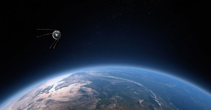
Ahí va un resumen de tablas con la descripción técnica y nomenclatura de las bandas satélite para la flota de Landsat y Sentinel.
Landsat 8
| Name | Resolution | Wavelength | Description |
|---|---|---|---|
| B1 | 30 meters | 0.43 – 0.45 µm | Coastal aerosol |
| B2 | 30 meters | 0.45 – 0.51 µm | Blue |
| B3 | 30 meters | 0.53 – 0.59 µm | Green |
| B4 | 30 meters | 0.64 – 0.67 µm | Red |
| B5 | 30 meters | 0.85 – 0.88 µm | Near infrared |
| B6 | 30 meters | 1.57 – 1.65 µm | Shortwave infrared 1 |
| B7 | 30 meters | 2.11 – 2.29 µm | Shortwave infrared 2 |
| B8 | 15 meters | 0.52 – 0.90 µm | Band 8 Panchromatic |
| B9 | 15 meters | 1.36 – 1.38 µm | Cirrus |
| B10 | 30 meters | 10.60 – 11.19 µm | Thermal infrared 1, resampled from 100m to 30m |
| B11 | 30 meters | 11.50 – 12.51 µm | Thermal infrared 2, resampled from 100m to 30m |
| BQA | Landsat Collection 1 QA Bitmask |
Landsat 7
| Name | Resolution | Wavelength | Description |
|---|---|---|---|
| B1 | 30 meters | 0.45 – 0.52 µm | Blue |
| B2 | 30 meters | 0.52 – 0.60 µm | Green |
| B3 | 30 meters | 0.63 – 0.69 µm | Red |
| B4 | 30 meters | 0.77 – 0.90 µm | Near infrared |
| B5 | 30 meters | 1.55 – 1.75 µm | Shortwave infrared 1 |
| B6_VCID_1 | 30 meters | 10.40 – 12.50 µm | Low-gain Thermal Infrared 1. This band has expanded dynamic range and lower radiometric resolution (sensitivity), with less saturation at high Digital Number (DN) values. Resampled from 60m to 30m. |
| B6_VCID_2 | 30 meters | 10.40 – 12.50 µm | High-gain Thermal Infrared 1. This band has higher radiometric resolution (sensitivity), although it has a more restricted dynamic range. Resampled from 60m to 30m. |
| B7 | 30 meters | 2.08 – 2.35 µm | Shortwave infrared 2 |
| B8 | 15 meters | 0.52 – 0.90 µm | Panchromatic |
| BQA | Landsat Collection 1 QA Bitmask |
Landsat 5 MSS
| Name | Resolution | Wavelength | Description |
|---|---|---|---|
| B1 | 60 meters | 0.5 – 0.6 µm | Green |
| B2 | 60 meters | 0.6 – 0.7 µm | Red |
| B3 | 60 meters | 0.7 – 0.8 µm | Near Infrared 1 |
| B4 | 30 meters | 0.8 – 1.1 µm | Near Infrared 2 |
| BQA | Landsat Collection 1 QA Bitmask |
Landsat 4 TM
| Name | Resolution | Wavelength | Description |
|---|---|---|---|
| B1 | 30 meters | 0.45 – 0.52 µm | Blue |
| B2 | 30 meters | 0.52 – 0.60 µm | Green |
| B3 | 30 meters | 0.63 – 0.69 µm | Red |
| B4 | 30 meters | 0.76 – 0.90 µm | Near infrared |
| B5 | 30 meters | 1.55 – 1.75 µm | Shortwave infrared 1 |
| B6 | 30 meters | 10.40 – 12.50 µm | Thermal Infrared 1. Resampled from 60m to 30m. |
| B7 | 30 meters | 2.08 – 2.35 µm | Shortwave infrared 2 |
| BQA | Landsat Collection 1 QA Bitmask |
Landsat 4 MSS
| Name | Resolution | Wavelength | Description |
|---|---|---|---|
| B1 | 60 meters | 0.5 – 0.6 µm | Green |
| B2 | 60 meters | 0.6 – 0.7 µm | Red |
| B3 | 60 meters | 0.7 – 0.8 µm | Near Infrared 1 |
| B4 | 30 meters | 0.8 – 1.1 µm | Near Infrared 2 |
| BQA | Landsat Collection 1 QA Bitmask |
Landsat 3 MSS
| Name | Resolution | Wavelength | Description |
|---|---|---|---|
| B4 | 60 meters | 0.5 – 0.6 µm | Green |
| B5 | 60 meters | 0.6 – 0.7 µm | Red |
| B6 | 60 meters | 0.7 – 0.8 µm | Near Infrared 1 |
| B7 | 30 meters | 0.8 – 1.1 µm | Near Infrared 2 |
| BQA | Landsat Collection 1 QA Bitmask |
Landsat 2 MSS
| Name | Resolution | Wavelength | Description |
|---|---|---|---|
| B4 | 60 meters | 0.5 – 0.6 µm | Green |
| B5 | 60 meters | 0.6 – 0.7 µm | Red |
| B6 | 60 meters | 0.7 – 0.8 µm | Near Infrared 1 |
| B7 | 30 meters | 0.8 – 1.1 µm | Near Infrared 2 |
| BQA | Landsat Collection 1 QA Bitmask |
Landsat 1 MSS
| Name | Resolution | Wavelength | Description |
|---|---|---|---|
| B4 | 60 meters | 0.5 – 0.6 µm | Green |
| B5 | 60 meters | 0.6 – 0.7 µm | Red |
| B6 | 60 meters | 0.7 – 0.8 µm | Near Infrared 1 |
| B7 | 30 meters | 0.8 – 1.1 µm | Near Infrared 2 |
| BQA | Landsat Collection 1 QA Bitmask |
Sentinel 1
| Name | Units | Min | Max | X Resolution | Y Resolution | Wavelength | Description |
|---|---|---|---|---|---|---|---|
| HH | -50 | 1 | 10 meters | 10 meters | 5.405GHz | Single co-polarization, horizontal transmit/horizontal receive | |
| HV | -50 | 1 | 10 meters | 10 meters | 5.405GHz | Dual-band cross-polarization, horizontal transmit/vertical receive | |
| VV | -50 | 1 | 10 meters | 10 meters | 5.405GHz | Single co-polarization, vertical transmit/vertical receive | |
| VH | -50* | 1 | 10 meters | 10 meters | 5.405GHz | Dual-band cross-polarization, vertical transmit/horizontal receive | |
| angle | Degrees | 0 | 90 | Approximate viewing incidence angle |
Sentinel 2
| Name | Resolution | Wavelength | Description | |
|---|---|---|---|---|
| B1 | 60 meters | 443.9nm (S2A) / 442.3nm (S2B) | Aerosols | |
| B2 | 10 meters | 496.6nm (S2A) / 492.1nm (S2B) | Blue | |
| B3 | 10 meters | 560nm (S2A) / 559nm (S2B) | Green | |
| B4 | 10 meters | 664.5nm (S2A) / 665nm (S2B) | Red | |
| B5 | 20 meters | 703.9nm (S2A) / 703.8nm (S2B) | Red Edge 1 | |
| B6 | 20 meters | 740.2nm (S2A) / 739.1nm (S2B) | Red Edge 2 | |
| B7 | 20 meters | 782.5nm (S2A) / 779.7nm (S2B) | Red Edge 3 | |
| B8 | 10 meters | 835.1nm (S2A) / 833nm (S2B) | NIR | |
| B8a | 20 meters | 864.8nm (S2A) / 864nm (S2B) | Red Edge 4 | |
| B9 | 60 meters | 945nm (S2A) / 943.2nm (S2B) | Water vapor | |
| B10 | 60 meters | 1373.5nm (S2A) / 1376.9nm (S2B) | Cirrus | |
| B11 | 20 meters | 1613.7nm (S2A) / 1610.4nm (S2B) | SWIR 1 | |
| B12 | 20 meters | 2202.4nm (S2A) / 2185.7nm (S2B) | SWIR 2 | |
| QA10 | 10 meters | Always empty | ||
| QA20 | 20 meters | Always empty | ||
| QA60 | 60 meters | Cloud mask |
Sentinel 3 OLCI
| Name | Units | Scale | Wavelength | Description |
|---|---|---|---|---|
| Oa01_radiance | W m^-2 sr^-1 μm^-1 | 0.0139465 | 400nm/15nm | Aerosol correction, improved water constituent retrieval |
| Oa02_radiance | W m^-2 sr^-1 μm^-1 | 0.0133873 | 412.5nm/10nm | Yellow substance and detrital pigments (turbidity) |
| Oa03_radiance | W m^-2 sr^-1 μm^-1 | 0.0121481 | 442.5nm/10nm | Chl absorption max., biogeochemistry, vegetation |
| Oa04_radiance | W m^-2 sr^-1 μm^-1 | 0.0115198 | 490nm/10nm | High Chl, other pigments |
| Oa05_radiance | W m^-2 sr^-1 μm^-1 | 0.0100953 | 510nm/10nm | Chl, sediment, turbidity, red tide |
| Oa06_radiance | W m^-2 sr^-1 μm^-1 | 0.0123538 | 560nm/10nm | Chlorophyll reference (Chl minimum) |
| Oa07_radiance | W m^-2 sr^-1 μm^-1 | 0.00879161 | 620nm/10nm | Sediment loading |
| Oa08_radiance | W m^-2 sr^-1 μm^-1 | 0.00876539 | 665nm/10nm | Chl (2^nd Chl abs. max.), sediment, yellow substance/vegetation |
| Oa09_radiance | W m^-2 sr^-1 μm^-1 | 0.0095103 | 673.75nm/7.5nm | For improved fluorescence retrieval and to better account for smile together with the bands 665 and 680nm |
| Oa10_radiance | W m^-2 sr^-1 μm^-1 | 0.00773378 | 681.25nm/7.5nm | Chl fluorescence peak, red edge |
| Oa11_radiance | W m^-2 sr^-1 μm^-1 | 0.00675523 | 708.75nm/10nm | Chl fluorescence baseline, red edge transition |
| Oa12_radiance | W m^-2 sr^-1 μm^-1 | 0.0071996 | 753.75nm/7.5nm | O2 absorption/clouds, vegetation |
| Oa13_radiance | W m^-2 sr^-1 μm^-1 | 0.00749684 | 761.25nm/7.5nm | O2 absorption band/aerosol correction |
| Oa14_radiance | W m^-2 sr^-1 μm^-1 | 0.0086512 | 764.375nm/3.75nm | Atmospheric correction |
| Oa15_radiance | W m^-2 sr^-1 μm^-1 | 0.00526779 | 767.5nm/2.5nm | O2A used for cloud top pressure, fluorescence over land |
| Oa16_radiance | W m^-2 sr^-1 μm^-1 | 0.00530267 | 778.75nm/15nm | Atmospheric correction/aerosol correction |
| Oa17_radiance | W m^-2 sr^-1 μm^-1 | 0.00493004 | 865nm/20nm | Atmospheric correction/aerosol correction, clouds, pixel co-registration |
| Oa18_radiance | W m^-2 sr^-1 μm^-1 | 0.00549962 | 885nm/10nm | Water vapour absorption reference band. Common reference band with SLSTR instrument. Vegetation monitoring |
| Oa19_radiance | W m^-2 sr^-1 μm^-1 | 0.00502847 | 900nm/10nm | Water vapour absorption/vegetation monitoring (max. reflectance) |
| Oa20_radiance | W m^-2 sr^-1 μm^-1 | 0.00326378 | 940nm/20nm | Water vapour absorption, atmospheric/aerosol correction |
| Oa21_radiance | W m^-2 sr^-1 μm^-1 | 0.00324118 | 1029nm/40nm | Atmospheric/aerosol correction |
| quality_flags | Quality flags |


